NASHVILLE, Tenn. (WKRN) — Days after 10 tornadoes ripped through Middle Tennessee, satellite images were taken of the damage. The two most powerful tornadoes caused impacts from Nashville to Cookeville.
The National Oceanic and Atmospheric Administration (NOAA) put together an interactive map of the areas impacted on March 2nd and 3rd, 2020.

An EF-3 tornado with maximum winds of 165 mph impacted Davidson and Wilson Counties. Causing destruction in the most populated parts of the state.
The tornado first dropped down west of Nashville. One of the first locations it impacted was John C. Tune Airport. The satellite images taken show airplanes tossed off the tarmac and hangars destroyed. At this point the tornado was an EF-2 with winds between 111 and 155 mph.


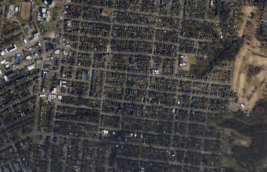
The tornado then moved through West Nashville, Germantown, and East Nashville. As it moved into East Nashville it strengthened to an EF-3 with winds between 136 and 165 mph. This caused roofs and top floors to be completely ripped off residential houses.


The tornado briefly weakened as it moved into Donelson and Hermatage. As it moved into Mt. Juliet it strengthened back into an EF-3. Entire factories had their roofs removed and 18-wheeler trailers were tossed across parking lots.


After impacting Lebanon, the tornado lifted off the ground. The same storm dropped another tornado as it moved into Putnam County.
This tornado rapidly strengthened into an EF-4 with maximum winds of 175 mph. The tornado went from ripping off roofs, to tearing houses from their slabs. Some neighborhoods west of downtown Cookeville were destroyed. As the tornado moved toward Tennessee Tech in downtown Cookeville, it weakened and lifted.


After Cookeville, the same thunderstorms dropped two more tornadoes in East Tennessee.
Don’t forget to take the power and reliability of the WKRN Weather Authority with you at all times by downloading the News 2 Storm Tracker app.