NASHVILLE, Tenn. (WKRN) — We are looking at another significant accumulating snow this coming week.

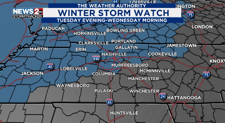
A Winter Storm Watch is in effect for Tuesday night through Wednesday morning for the possibility of 2-5 inches of snow across parts of Middle Tennessee and Southern Kentucky. The watch includes counties along the I-40 corridor and northward where the heaviest snow is anticipated.
The best way to get a large accumulating snow in the mid-south is from a Gulf Low mixing with cold air.

That’s exactly what we are looking at Tuesday night through Wednesday morning when a low-pressure center is forecast to skirt the Louisiana-Mississippi-Alabama coastline, with subfreezing air in place in Middle Tennessee and Southern Kentucky.
It’s early to pinpoint precise accumulation amounts, but a “preliminary” forecast depicts a possible 2-4 inches of snow across Nashville and much of the north half of Middle Tennessee with possibly 4-6 inches near the border with Kentucky northward.
Our southern counties will likely see the least where there could be a mix of rain and snow at times.

This snowfall will likely affect travel starting Tuesday night.
Temperatures are forecast to remain well below freezing Wednesday through Saturday morning, so it may take a while to return life back to normal after this coming snowfall.
We’ll keep you posted!
Don’t forget to take the power and reliability of the WKRN Weather Authority with you at all times by downloading the News 2 Storm Tracker app.