NASHVILLE, Tenn. (WKRN) — The first month of 2025 has been extremely cold across Middle Tennessee and Southern Kentucky. Twenty out of the first 25 days of the year had colder-than-normal temperatures in Nashville.
If you are sick of the Arctic air, there is some good news for you. The Climate Prediction Center‘s 6 to 10 day temperature outlook shows a very high chance for warmer than normal temperatures for the first week of February.

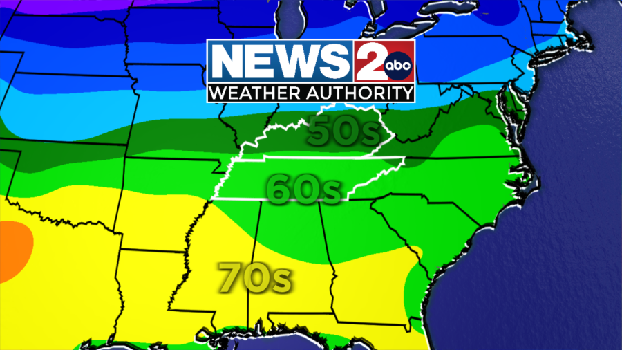
This warm trend starts this week as temperatures will warm to near 60° on Wednesday, Jan. 29. High temperatures in the upper 50s and low 60s will continue into the first weekend of February.

Temperatures in the mid-60s will continue into the first week of February, too.
According to the American and European forecast models, temperatures will be 15 to 20° warmer than average. Nashville’s average high for the first week of February is around 50°, which means there could be afternoon temperatures near 70°!
The Climate Prediction Center agrees. Their 10 to 14 day temperature outlook shows a high chance for above average temperatures from Feb. 3-9.

We will have to keep an eye out for severe thunderstorms when temperatures warm up this time of year. February is when we start seeing a higher chance for severe weather, including possible tornadoes. February is the fourth most active month for tornadoes in Tennessee.

As of publication, there is not a significant severe weather threat within the next week or so, but with warmer temperatures in the forecast, it’s something we are going to watch closely.
We are entering the most active time of year for tornadoes. Now is a good time to go through your tornado safety plan, make sure your weather radio has fresh batteries and have ways to stay informed about severe weather threats in your area.
Don’t forget to take the power and reliability of the WKRN Weather Authority with you at all times by downloading the News 2 Storm Tracker app.